Story: Ngo Quang Minh
Photos: Nguyen Thanh Hai, Ngo Quang Minh
Join us on a patriotic journey to the islands that serve as Vietnam’s frontline defense outposts.
Over 3,000 large and small islands are distributed along the coast of Vietnam’s S-shaped mainland, including the two offshore archipelagos of Truong Sa and Hoang Sa. These islands serve as frontline defense outposts and a maritime shield that protects the country. They also serve as the baseline for determining internal waters, the territorial sea, the contiguous zone, the exclusive economic zone, and the national continental shelf. The East Sea is also one of the world’s busiest maritime routes, playing a vital arterial role in connecting global trade and linking the Pacific Ocean with the Indian Ocean. Therefore, the presence of Vietnam’s islands and archipelagos is not only of vital territorial significance but also crucial for security, the economy, and international trade.
Throughout history, from the 17th to the late 19th century, despite changing dynasties, the Vietnamese feudal state consistently fulfilled the sacred mission of safeguarding maritime and island sovereignty and territorial integrity. From the era of the Nguyen Lords to the Dai Viet state under the Tay Son dynasty, and later the Nguyen court, the Hoang Sa flotilla, which also commanded the Bac Hai flotilla, excelled in its mission to survey waterways, plant markers, and erect steles, as well as managing and organizing administrative units for the two archipelagos. This is documented in the vermilion records of the Nguyen Dynasty and in royal edicts and texts. From the French colonial period through 1975 to the present, Vietnam has continued to consolidate and exercise its lawful sovereignty over its sacred territory in accordance with international legal conventions, while developing infrastructure and enriching the spiritual life of military personnel and civilians in the island districts.
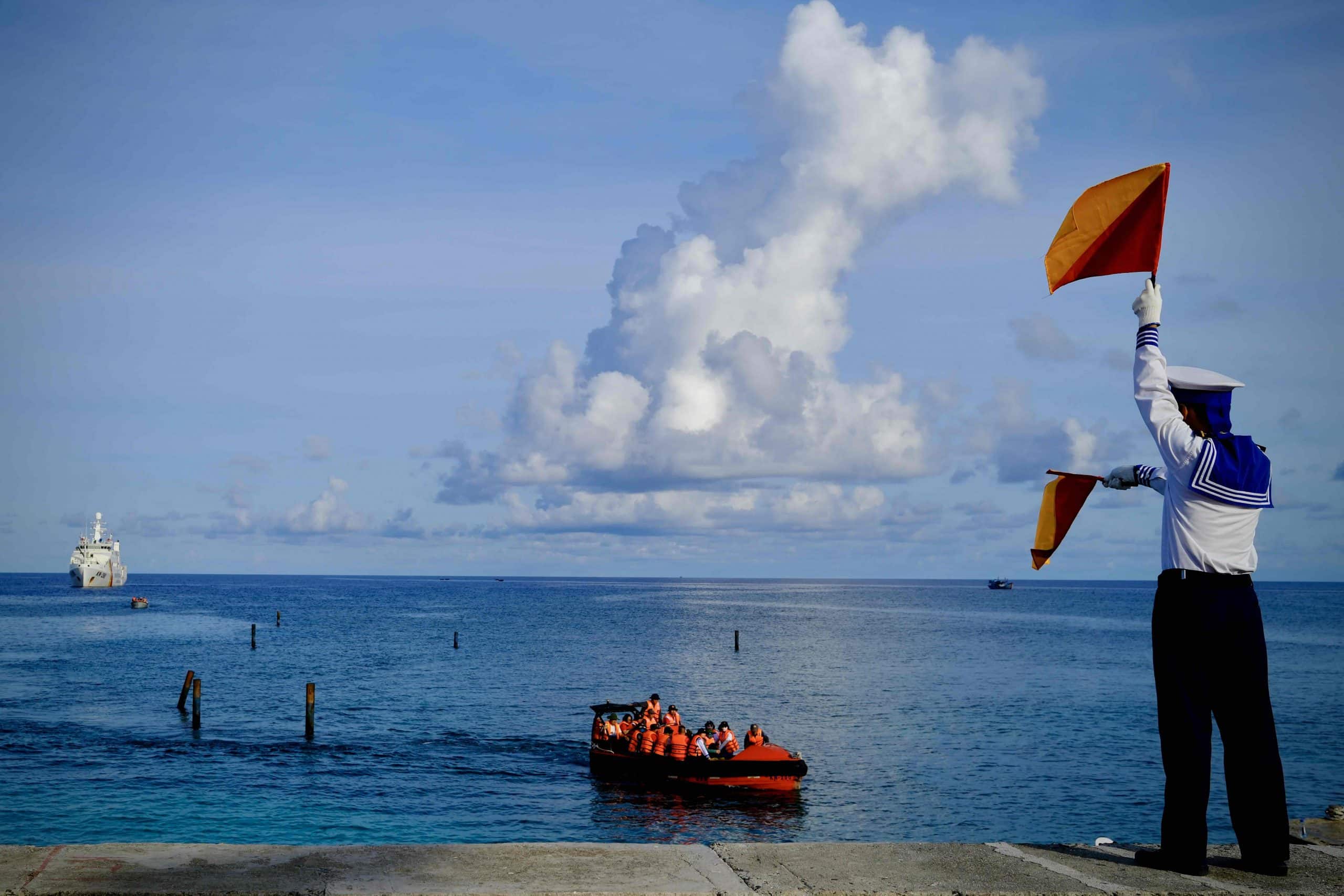
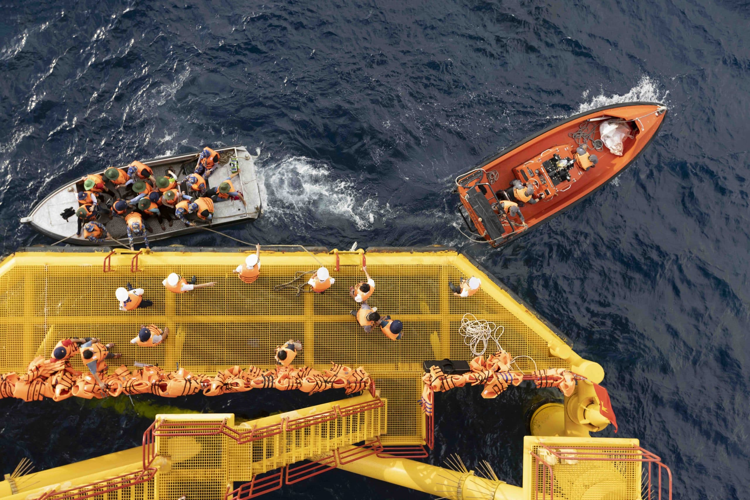
Alongside these historical footprints, our ancestors proudly left their mark amid the open ocean and its strategic geopolitical role. The maritime culture and daily lives of those living in Truong Sa offer a profoundly novel and unique journey of discovery. A journey to this area usually lasts several days aboard a fisheries surveillance vessel, crossing hundreds of nautical miles from the mainland to the frontline islands and offshore platforms located at the forefront of the East Sea’s winds and waves.
The first destination worth mentioning is An Bang Island, dubbed the “beautiful girl” of the Truong Sa archipelago. This island is difficult to approach due to its unique topography, which is battered by large waves year-round. Formed by linked coral reefs with vertical structure, the island faces crashing waves in all four seasons, making entry and exit challenging. At times, special forces must swim out to tow in boats and bring people and cargo ashore. An Bang’s soil consists of nutrient-poor coral sand. The island lacks fresh water, and high temperatures combined with extreme salinity make cultivation difficult.
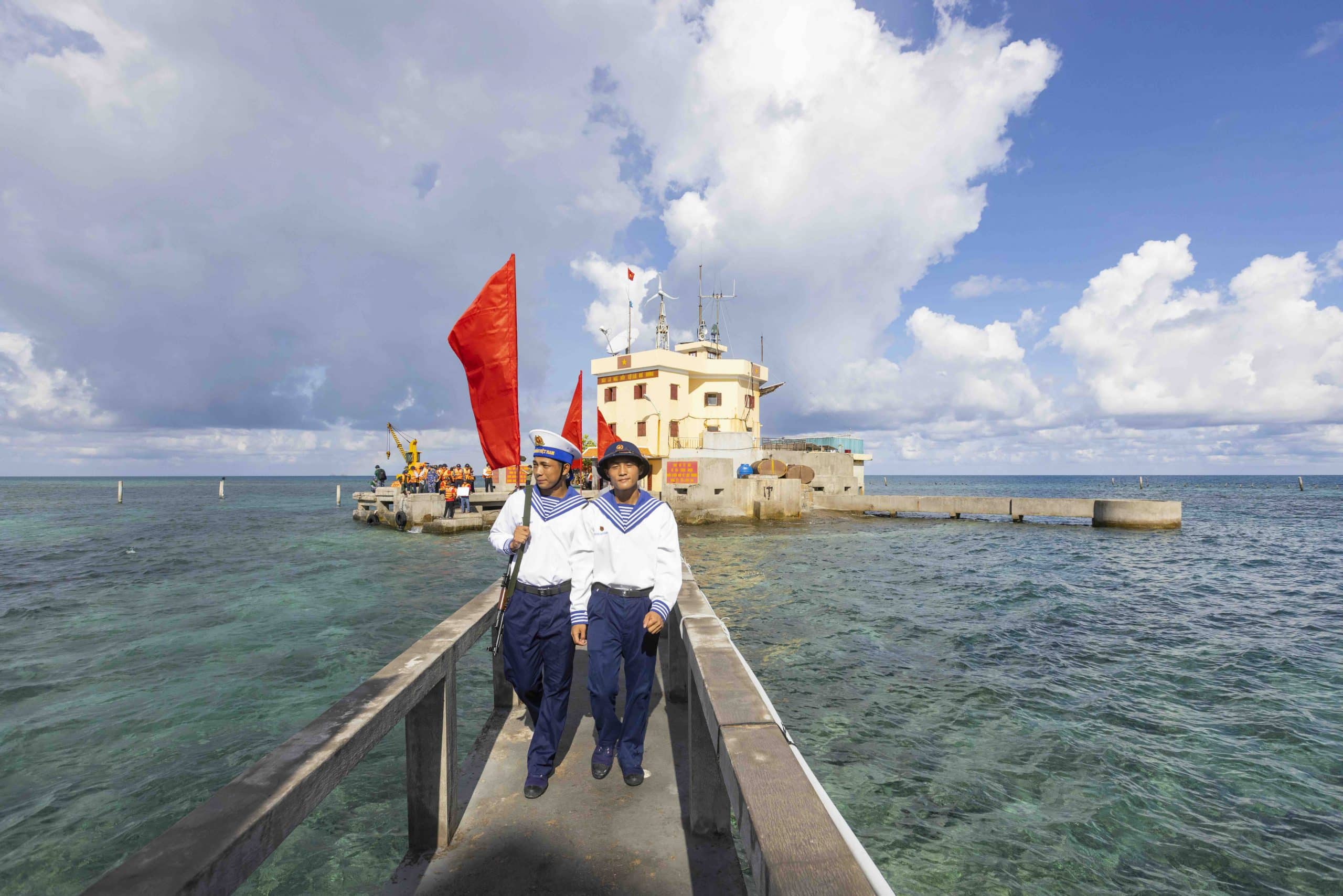
However, the name “An Bang” (meaning “bringing peace and stability to the nation”) embodies the determined will of the Vietnamese people in general and the soldiers on this island in particular. Through the hard work of many generations, this island has gradually been transformed into a vibrant oasis, its land reclaimed and greened. Today, An Bang is known for the sturdy canopies of the octopus bush, along with the square fruits of the fish poison tree, which, at a mere glance, are recognized as “gifts of Truong Sa” and found nowhere else. Another iconic image is the island’s lighthouse, which soldiers proudly declare “must never be extinguished.” As they assert, the An Bang lighthouse serves not only as a navigational beacon for ships in the area but also as a symbol of national sovereignty at sea.
One cannot fail to mention Truong Sa Lon island – the center of the Truong Sa special zone, a frontline citadel bearing the shape of the Fatherland in the East Sea. Here, generations of cadres, soldiers, and civilians have poured their sweat, effort, and even the blood of their youth to turn barren sand and rock into a lush, green Truong Sa, making the island a home and the ocean a homeland. The characteristic hydrometeorological conditions during the dry season, with calm waves and tranquil seas from February to May, allow delegations from the mainland to visit the island, and fishermen to catch seafood and stop by to exchange necessities. The center of Truong Sa Lon Island boasts a lighthouse, civilian households, a clinic, a school, a meteorological station, a guesthouse, an Uncle Ho memorial site, a martyrs’ monument, and a pagoda.
Truong Sa Lon Pagoda is one of nine pagodas across the entire archipelago. This is not merely a place where civilians and members of the military on the island pray for peace, but also a sacred sanctuary to express gratitude to the generations of Vietnamese people who came from afar and merged with the waves to secure the nation’s maritime borders. The flag-saluting ceremony, the singing of the National Anthem, and troop review ceremonies on Truong Sa Lon Island are especially moving. Amid the sun and wind of the East Sea, beneath a large national flag with its five-pointed star, visiting delegations join members of the military and civilians from this island district to sing the national anthem, their united voices full of honor and pride.
Every sea voyage must eventually end in farewell. From the deck of our ship, we waved goodbye to the military staff and civilians from all over Truong Sa Lon Island, who stood solemnly on the pier to see our delegation off. The mainland forever cherishes Truong Sa, forever cherishes the sons and daughters who chose to grow up alongside the waves and forge the meaning of their lives on the open sea.


