Truong Quy
Looking at a map of Vietnam’s North, you’ll find the Duong River in the middle of many ancient cultural centers. Culture and history have long flowed along the Duong River, which connects the Red and Thai Binh river systems. Known as “Thien Duc” or “Thien Duc Giang” in Chinese characters, the river is 68km long, flowing from Dau junction (between Hanoi’s Long Bien and Dong Anh districts) to My Loc village junction, Cao Duc commune, Gia Binh district, Bac Ninh province. This alluvium-rich flow carries the essence and history of the Vietnamese people who have lived beside it for thousands of years.

The river’s sparkling stream
The Duong’s position as both the geographical and cultural center of Kinh Bac is clearly described in Hoang Cam’s poem Bên kia sông Đuống (Across the Duong River): “Whoever crosses the Duong / Take this black silk for me / For hundreds of years we’ve dreamt of peace.”
The Duong forms the natural boundary between the semi-mountainous region to the north and the river delta to the south. From there onwards, only a few small hills stand among vast swathes of fertile fields. In terms of administrative geography, the Duong connects the two banks of Bac Ninh province, formerly Thuan An and Tu Son wards in the old Kinh Bac region.

of Duong River
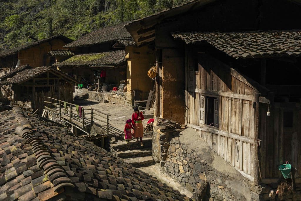
The northern bank, which used to be Tu Son ward, is an age-old cultural center filled with countless historic sites and famous quan họ villages, extending to the banks of the Cau River and Bac Giang province. The southern bank, which used to be Thuan An ward and changed its name to Thuan Thanh, is considered the first place in Vietnam’s North to adopt Buddhism. It extends from the left bank of the Red River to Luc Dau Giang, where many victories against foreign invaders were recorded. The Duong mixes with the Cau, Thuong, Luc Nam, Kinh Thay, and Thai Binh rivers to create a destination where these six rivers converge. Four of these rivers carry water from upstream and are respectively given names derived from the word “Đức” (“good thing”), a prime example of the ancient philosophy of harmony: Thien Duc (the Duong) represents the sky, Nguyet Duc (the Cau), the moon, Nhat Duc (the Thuong), the sun, and Minh Duc (the Luc Nam), clarity. These are also the four rivers that make up the landscape of ancient Kinh Bac.

Visitors can travel by waterway from where the Duong separates from the Red River to reach the area with the richest concentration of historic relics in Vietnam. Key sites include the Giong Temple – Kien So Pagoda (Phu Dong) complex associated with the legend of Saint Giong of the Hung King period. Visitors will find some of Vietnam’s most famous landmarks, including Nhan Pagoda (Ninh Hiep), Sui Pagoda (Phu Thi), and Keo Pagoda (Kim Son), medieval Buddhist centers in Gia Lam district (Hanoi), and pagoda relic clusters such as Phat Tich Pagoda on Lan Kha Mountain (Tien Du district) opposite But Thap Pagoda, and the Luy Lau cultural area with Dau Pagoda and the remains of the Luy Lau Ancient Citadel (Thuan Thanh district) at its core.
Traveling along the meandering, dragon-shaped course of the Duong leads to the temple of Kinh Duong Vuong, the Dong Ho painting village, and the foot of Thien Thai Mountain. Here lies a temple dedicated to Grand Master Le Van Thinh, the first valedictorian of the Vietnamese Confucian court examinations in the 11th century.

From here, the Thien Duc passes through Le Chi Vien Garden, once associated with the tragedy of the great poet Nguyen Trai, a meritorious official of the Le dynasty. The river continues to Dai Bi Pagoda, built during the Tran Dynasty by Huyen Quang, the Third Founder of the Truc Lam Buddhism sect, in his hometown in 1305. The river meanders southward, flowing through the tomb and temple of Cao Lo Vuong, the general who invented the magic crossbow and built the ancient Co Loa Citadel in the third century BC. Finally, the river flows to Binh Than Wharf, merging with the Thai Binh at Luc Dau Giang. It was in this magnificent setting that the Binh Than Conference took place in 1283 and the Tran Dynasty devised its battle plans to repel the Yuan Mongols, then invading Dai Viet for the second time. This was due to the strategic position of the Duong as the shortest waterway from the sea mouth to Thang Long Citadel. Today, the Duong still connects tourism regions, from Con Son – Kiep Bac (Hai Duong) to further places like Hai Phong and Quang Ninh. Visitors can explore the same route their ancestors sailed hundreds of years ago.

Memorial Board
Exquisite arts and colors
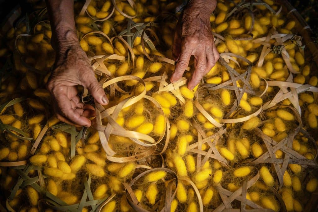
While the Duong is not long, it played an essential role in the formation of Dai Viet over thousands of years. As well as carrying historical lessons, the Duong bears cultural treasures in the form of village landscapes, local agriculture, and handicrafts that comprise the unique identity and prosperity of this rural region. The name of the Dau region and the Dau River, a branch of the old Duong, allude to the area’s famed mulberry cultivation, sericulture, and fabric-weaving. Old verses like “O homeland, sweet fragrance of rice / Vibrant Dong Ho paintings of chickens and pigs … Bustling Ho and Sui markets / And Tram Chi’s grounds full of weavers…” still hold true to this day. Visitors can explore bustling Dong Ho, known for its traditional paintings, Xuan Lai bamboo and rattan village, and Dai Bai bronze casting village.

This region is also home to national treasures, such as a stone statue of Amitabha Buddha and the sacred beasts of Phat Tich Pagoda, which date back to the 11th century. Visitors can also admire the thousand-eyed, thousand-armed Guanyin statue and an array of beautiful wooden statues from the 17th-18th centuries in But Thap and Dau Pagodas. These works reveal the height of craftsmanship and artistry in this riverside region. The architecture of these places has given birth to the term “Northern pagoda” in the old adage “Southern bridge, Northern pagoda, Doai communal house”, praising the beauty of the country’s landmarks.
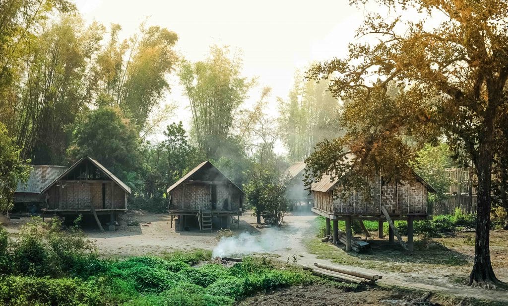
The Duong retains its lovely scenery of river landscapes and villages along the dams, together with its aquatic resources and riverside agricultural products. For thousands of years, alluvial deposits have been transformed into fields, forming an area for agricultural cultivation and creating unique farming practices. Areas in the middle of the river, such as the alluvial ground of Nguyet Ban at the river’s mouth where it flows into the Thai Binh are also ecological areas that showcase locals’ hard work as they make the most of the bountiful resources gifted by Mother Nature.

The Duong could be compared to a huge open-air museum for those wishing to learn about the culture and history of the Vietnamese people. Just by riding a bicycle along the dams or sitting on a boat in the middle of the river, you can discover thousands of years of the glorious past. This river is filled with scholars’ poetic aspirations and farmers’ love songs in the festive season. Explore the age-old customs of this fertile region.


