Story: Truong Quy
Photos: Quang Ngoc
Discover a landscape shaped by rivers, tides, sediment, and generations of human effort at Vietnam’s southern tip.
Arriving in present-day Ca Mau, or journeying across the expansive reach of Dat Mui (The Cape), means stepping onto a landmark deeply tied to Vietnamese national pride. The roughly 110-kilometer road from the provincial capital to the nation’s southernmost point winds through a landscape of constant coastal breezes and an unbroken green canopy of cajeput, mangrove, and avicennia trees. Evoking the melody of a familiar folk song, a journey to Dat Mui opens onto an endless horizon, where lush forests stretch beneath an open blue sky to meet two sea fronts colored brown by rich alluvium.
The prow of “Vietnam’s ship”
The route from downtown Ca Mau City to Dat Mui follows National Highway 1 through an enchanting landscape of rivers and interlacing canals, passing Ganh Hao, Bay Hap, and Cua Lon before reaching Nam Can. From there, it continues as the Ho Chi Minh Road to the nation’s southernmost point.
Driving along this corridor through dense stretches of cajeput, mangrove, and avicennia forests, one can often catch glimpses of the sea in the distance while feeling as though the journey has no end. A traveler might wonder whether this land even existed a century ago. School geography textbooks once taught that Ca Mau Cape advances into the sea by 80 to 100 meters each year. Yet from the moment silt settles into a mudflat until the land becomes solid enough to support houses and hamlets, several generations must pass. The highway resembles the spine of some strong creature reaching steadily toward the open sea, flanked on all sides by an unbroken horizon of verdant woodland and intersecting canals. Travelers can feel as though they are floating on a moving green islet.
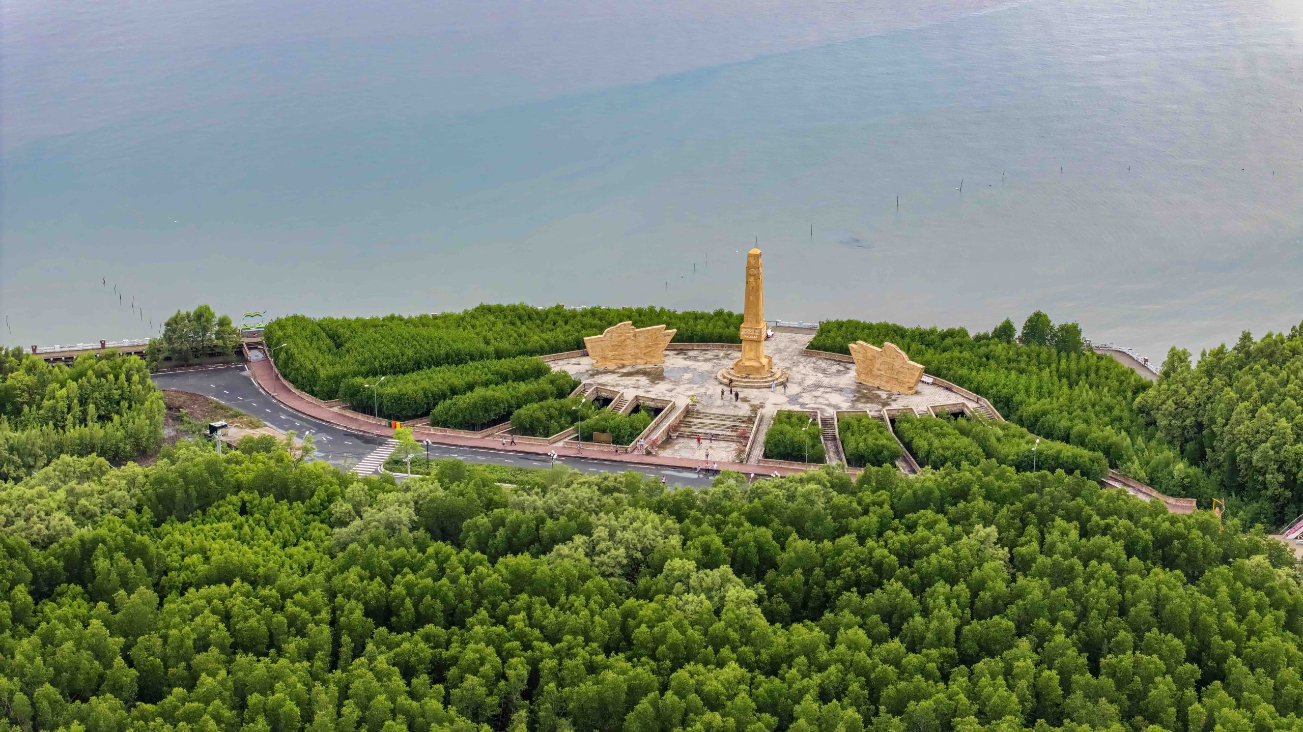
Visitors to Dat Mui are often reminded of a famous verse by the celebrated poet Xuan Dieu: “My Fatherland is like a vessel, and there lies our ship’s prow, the cape of Ca Mau.” This line is inscribed on a ship-shaped monument at coordinates 8°37′30″ N and 104°43′ E, marking Vietnam’s southernmost mainland point. Every traveler pauses before this compact monument, its white sails and red national flag standing out against the blue sky and sediment-rich sea.
An ongoing journey
Some have compared Ca Mau Cape to a giant’s big toe, stepping into the mudflats, reflecting the tireless reclamation efforts of generations of Vietnamese settlers. This process follows a natural succession: avicennia leads the advance, mangroves take root right behind, and cajeput closely follows. These resilient trees possess root systems that harvest every bit of nourishment from the saline mud. Beneath the vast green canopy lie deep reddish-brown soil and tidal creeks dark with silt, reminiscent of the traditional brown peasant tunics of former times. A lyric from the song Tinh Ca (Love Song) by composer Pham Duy recalls the historic journey of the Vietnamese pioneers opening up the southern frontier over generations. Along the East Sea, where ocean currents surge out into the Pacific, the footprints of ancestors gave birth to Ca Mau. Nature provided the accumulating silt, but human toil and sweat forged a monumental imprint from millions of anonymous footsteps.
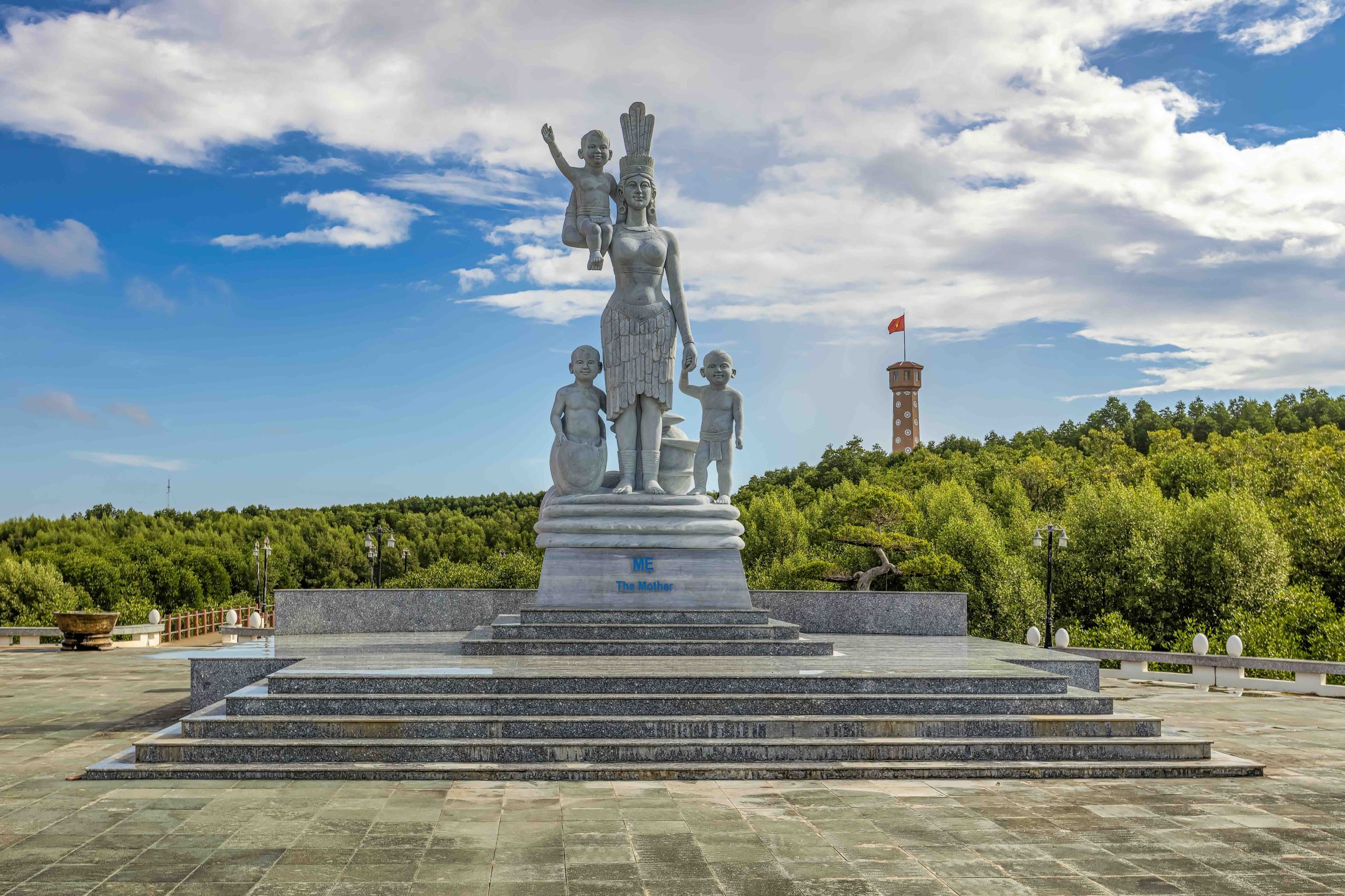
The red lighthouse
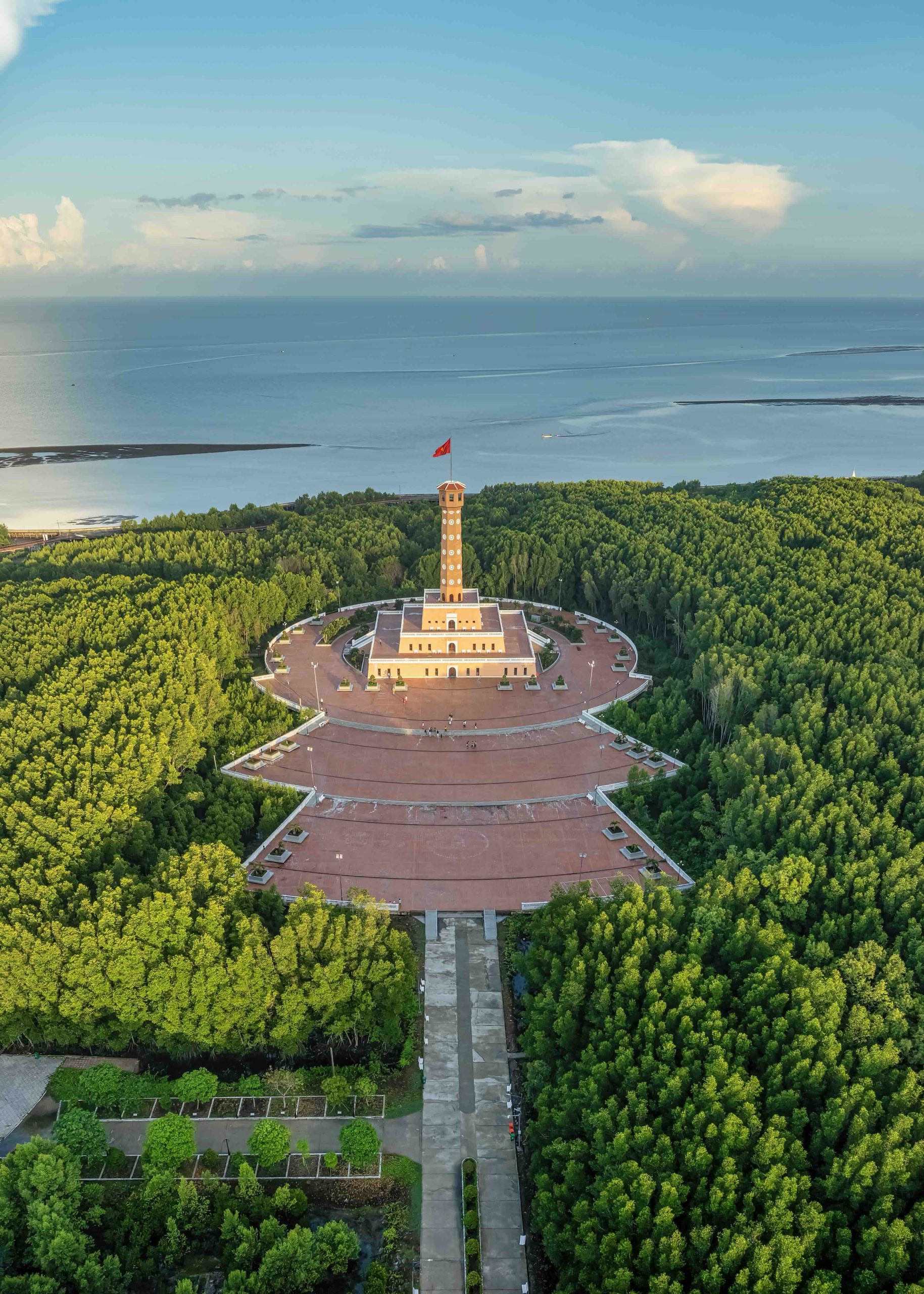
Beyond the National Coordinate Marker designated GPS 0001, the journey across Ca Mau Cape now includes several iconic historical and cultural sites: the Lac Long Quan Temple and Mother Au Co Statue, the Ca Mau Cape Flag Tower, and the monument marking the end of Ho Chi Minh Road. Against the deep green foliage, the brick-red tones of the temple’s curving eaves evoke traditional heritage architecture, while the striking 45-meter Flag Tower, modeled after the Hanoi Flag Tower, stands out as a prominent landmark. Presented as a gift to Ca Mau by the government and people of Hanoi, the structure resembles a lighthouse watching over two seas. Inside, the tower houses exhibition galleries chronicling the history of Ca Mau Cape alongside representative cultural heritage sites of the capital. Most notably, a 250-step interior staircase leads visitors to the summit, offering an unobstructed, panoramic view across vast mangrove and cajeput reserves bordered by both the East Sea and the West Sea, also known as the Gulf of Thailand.
Exploring Mui Ca Mau National Park is another memorable experience. Boarding an electric tram that glides over elevated wooden walkways, combined with a leisurely walk, takes about two hours to gain a firsthand sense of this fertile region where “the soil itself bears life”, as described in Hoang Hiep’s song Ve Dat Mui. Hiring a boat lets travelers slip deeper into narrow channels, reach emerging tidal shoals, and witness the “walking land”, a vivid local metaphor for the daily sedimentation driven by the flows of the Cua Lon and Bay Hap rivers and the dense canal network that connects back to the Hau River. Beneath the mud, fish, crabs, and brackish-water wildlife thrive in a remarkably fertile ecosystem.
Stopping at palm-thatched eateries along secondary paths or canal banks, visitors can enjoy local Dat Mui fare. While these dishes belong to the broader delta culinary tradition, the seafood’s exceptional freshness leaves a lasting impression. Ca Mau crab has become an acclaimed local specialty, a culinary standard few other places can rival.
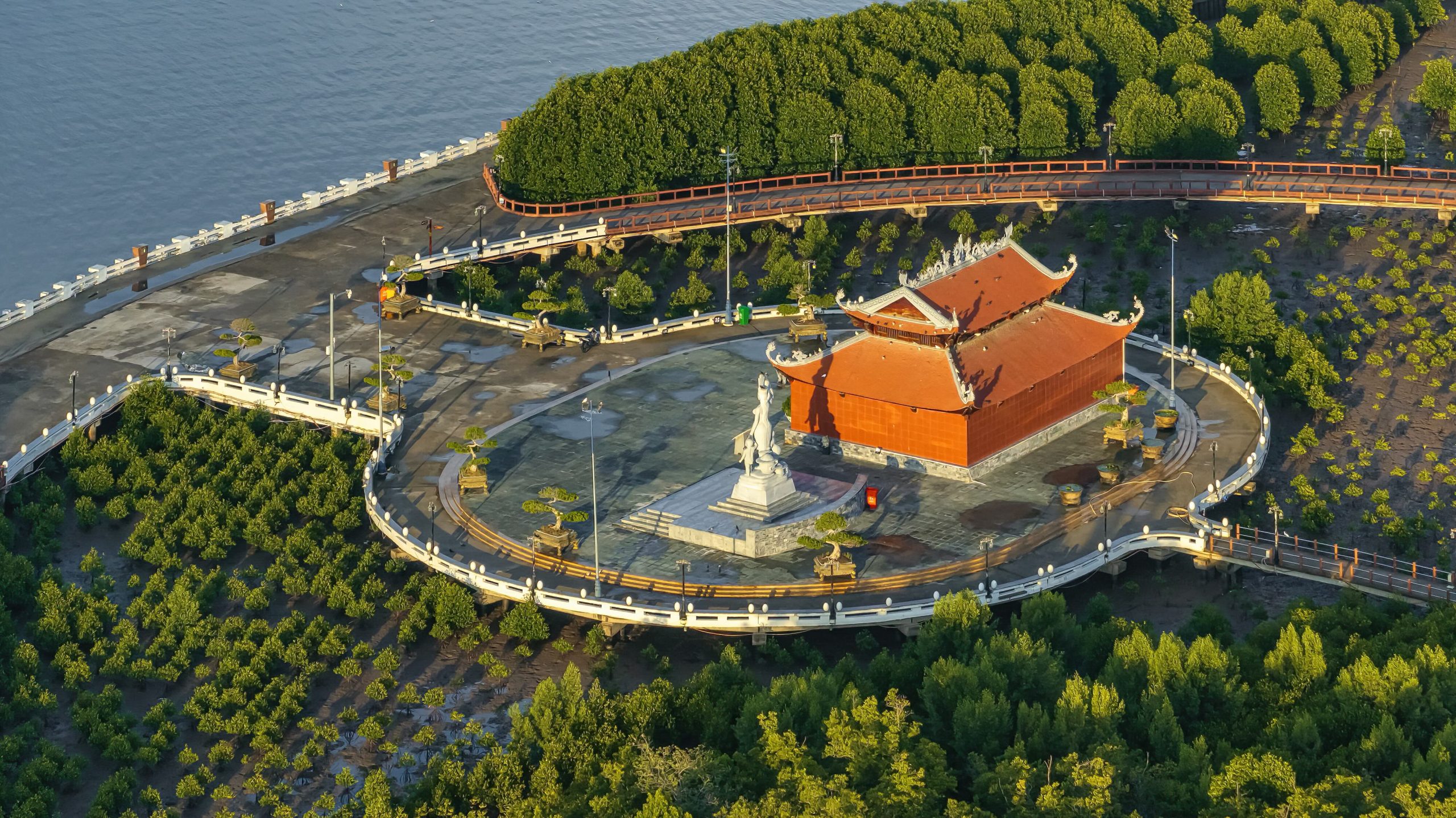
Where the sun rises and sets over the sea
At dusk, Dat Mui offers a rare vantage point to watch the sun sink into the sea, making it the only mainland location in Vietnam where visitors can see both sunrise and sunset over the water in the same day. Continuous sedimentation is gradually shifting Ca Mau Cape westward. Meanwhile, roughly 15 kilometers east of the cape, the Khai Long area has accumulated new alluvial shoals toward the south, accompanied by an underway sea-bridge project planned to connect to Hon Khoai Island. These ongoing transformations ensure that Ca Mau Cape remains an enduring, living testament to the boundless vitality of the Vietnamese people across generations.
Please visit www.vietnamairlines.com for more information and details of special offers.