Story: Truong Quy
Photos: Kim Dung, Phong Nguyen
Stretching from North to South over plains and mountains, Vietnam’s “thousand-mile” road tells of endurance, ambition, and forward motion.
When studying the country’s geography, every Vietnamese student learns of the trans-Vietnam road stretching from Nam Quan Pass (now renamed Huu Nghi (Friendship) Pass) to Cape Ca Mau. Spanning 2,482 kilometers, this route crosses numerous mountainous regions, including the Truong Son Range in Central Vietnam, whose spurs extend toward the sea.

This thien ly (thousand-mile) road crosses these mountain ranges through a series of rugged passes. Each lofty pass tests travelers’ steps and testifies to the Vietnamese people’s centuries-long mastery of their terrain.
Because the country’s topography stretches from North to South, the thousand-mile road was built long ago. In the Complete Annals of Dai Viet, it’s recorded that in the third lunar month of the Nham Ngo year (1402), under the Ho dynasty, King Ho Han Thuong “ordered the construction and repair of roads from Tay Do Citadel to Hoa Chau. Along the way, streets and courier stations were established on what was named the thien ly road.” Extended over many centuries, this road was renamed National Highway 1 in the 20th century. It became part of today’s National Highway 1A, which runs parallel to the North-South expressways and the Ho Chi Minh Highway. Together, these routes form the country’s vital transportation system.
Ten thousand miles across the motherland
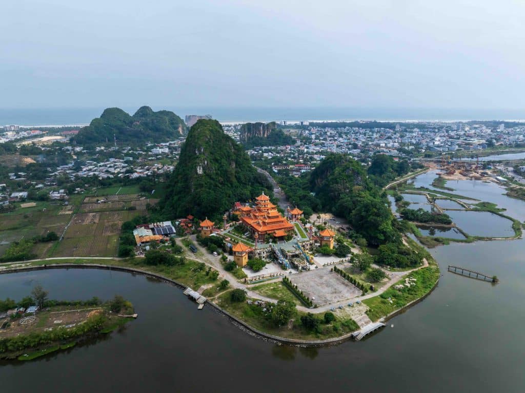
The old national highway begins in the frontier province of Lang Son, passing through the first pass, Sai Ho. Over 5km long and 362m high, Sai Ho Pass connects with the rugged terrain of Chi Lang Pass to the southwest. It winds through a low mountain range between the Bac Son Arc and scattered limestone mountains, creating a formidable gateway into the Northern Delta.

This region bears the footprints of our ancestors’ explorations, and was the site of the famous Battle of Chi Lang in 1427, which marked the Lam Son insurgent army’s victory over invading Ming forces and led to the dawn of the early Le dynasty of Dai Viet.
From the Northern Delta heading south, the thousand-mile road encounters the Tam Diep Mountains, which form the boundary between the North and the North Central Coast. On the rudimentary trail hewn by ancient Vietnamese people, this mountain pass, though only about 110m high, was known for being treacherous. The route consists of three successive passes stretching about 7km, beginning at Dau Temple in Ninh Binh and ending at Song Son Temple in Thanh Hoa. Collectively known as Ba Doi Pass, these three inclines entered the realm of poetry in a famous 18th-century verse by the poet Ho Xuan Huong, known for her witty and suggestive double-entendres: “One pass, one pass, and yet another pass. Praise be to whoever skillfully carved this perilous landscape… What sage or gentleman wouldn’t, despite weary knees and tired legs, still want to climb?”
A stone stele erected near the pass by King Thieu Tri in 1842, and nearby sacred temples, create a culturally and spiritually rich area.
Passing the plains of the Thanh – Nghe – Tinh region, the Truong Son Range begins, its peaks thrusting horizontally toward the sea. The first summit, Hoành Son, is known as the “horizontal mountain” and divides the provinces of Ha Tinh and Quang Tri, creating Ngang Pass on the thousand-mile road. This is the boundary from which the Vietnamese began their southward expansion at the end of the first millennium.
Climbing the stairs built by King Minh Mang in 1833 to Hoanh Son Pass at the summit, travelers can still feel the nostalgia of Ba Huyen Thanh Quan (the Thanh Quan District Chief’s Lady) in her famous poem Crossing Ngang Pass: “Stepping onto Ngang Pass as the sun’s shadow slants. Grass and trees crowd the rocks, leaves crowd the flowers…”

Leaving Ngang Pass, the overland route runs along a narrow coastal plain, entering the Hue region before crossing the Bach Ma Mountains. Jutting into the sea, this range features some of Vietnam’s most dangerous passes. Stretching 3.2km south of Cau Hai Lagoon, Phuoc Tuong Pass occupies a strategic and perilous position on the road linking Hue and Danang.
Continuing south for about , the thousand-mile road reaches breathtaking Lang Co Lagoon, marking the start of Vietnam’s most famous mountain road, Hai Van Pass. This route is immortalized in Hue folk songs, which describe a desolate scene amidst crying birds and howling apes, as in the song Ly qua deo: “Each afternoon I lead my mother across the pass. Birds call, birds call – love lingers on the other side. “
A journey of reunion
Stretching over 21km and reaching an altitude of 500m, Hai Van Pass once formed the border between Dai Viet and Champa, following the 1306 marriage of Jaya Simhavarman III and Princess Huyen Tran. At the summit lies Hai Van Pass Gate, built by King Minh Mang in 1826 and inscribed with the words: “The most majestic pass under heaven.”
Following the coastline, Hai Van Pass, along with the trans-Vietnam railway built by the French in the early 20th century, is now considered one of the most spectacular routes in the world. After reunification in 1975, Hai Van Pass became a symbol of reunion and trade between the North and the South, and synonymous with love, as in the lyrics of Phan Lac Hoa’s song Tau anh qua nui (My Beloved’s Train Crosses the Mountain): “Traveling through Vietnam, following the turning wheels of the train, crossing Hai Van Pass with clouds flying over the mountain peaks. Missing each other, I am waiting for you to arrive…”
The thousand-mile road runs through the South-Central Coast, tracing the shoreline, skirting narrow plains beside short rivers, and winding through spurs of the Truong Son Range that reach almost to the sea.

Among its most striking stretches are Cu Mong Pass, the Ca Pass – Co Ma Pass cluster, and Ru Ri Pass, each offering sweeping views over some of Vietnam’s most beautiful bays. Cu Mong Pass overlooks Bai Xep (Gia Lai), while Ca Pass and Co Ma Pass curve in succession around Vung Ro Bay and Dai Lanh Beach.
Ca Pass, linked with Da Bia Mountain, once marked the southern boundary of Dai Viet, established by King Le Thanh Tong in 1471.
Inspiring legends with its dangerous and torturous bends, Ru Ri Pass is now only a secondary branch road. Still, it draws curious travelers seeking novelty at the gateway to the coastal city of Nha Trang.
In the southernmost part of the Central region, the thousand-mile road flattens as it enters the South, continuing all the way to Nam Can Cape in Ca Mau, the country’s southernmost mainland tip. As the ancients said, “The road is not difficult because mountains and rivers block it; it is difficult because the human heart fears mountains and rivers.”
The history of this thousand-mile road stands as a testament to the Vietnamese people’s resilience in overcoming life’s obstacles. Along it lie passes worn smooth by the countless footsteps of those who crossed the mountains, creating a road that’s symbolic of moving forward and never turning back.


