Vinh Dav
Mountains cover three-quarters of Vietnam’s territory, resulting in many treacherous roads. Many winding passes, with sheer cliffs on one side and deep abysses on the other, have been immortalized in poetry as masterpieces of nature:
The winding slopes rise steeply, vast and deep,
In the desolate clouds, rifles seem to touch the sky.
(Excerpt from Tay Tien by Quang Dung)
Known as the Four Great Passes – Ma Pi Leng in Ha Giang, O Quy Ho in Lao Cai – Lai Chau, Khau Pha in Yen Bai, and Pha Din in Son La – Dien Bien – are symbols of grandeur and tests of courage for those who love to explore. All four passes are located in high mountainous regions, resulting in winding roads with large scales and steep gradients.
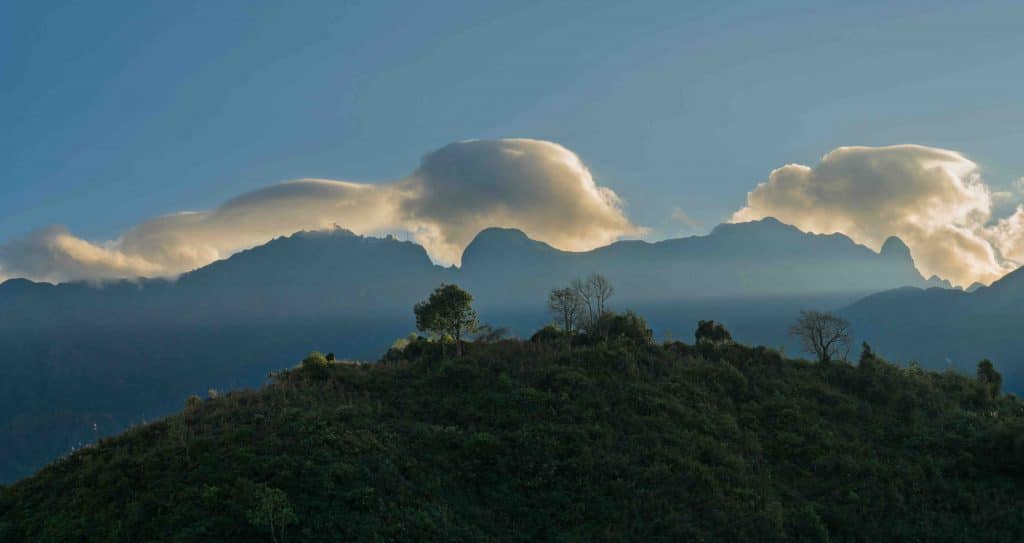
Located in the far North and separated from the other three great passes, Ma Pi Leng lies on the road named Hanh Phuc (Happiness), the lifeline connecting Dong Van District with Meo Vac District. More than a transportation route, this is a symbol of the historic sacrifices, indomitable will, and unity of thousands of volunteer youths and indigenous mountain people. Despite being the shortest of the four passes, stretching only some 20km long, Ma Pi Leng is dubbed the “King of Vietnamese Passes” due to its treacherous nature and spectacular scenery. From its highest point at approximately 1,400m above sea level, one can gaze down at Tu San Gorge, where the emerald-green Nho Que River flows 800m below. On one side are towering white cliffs, and on the other is one of the deepest abysses in Southeast Asia. The harmonious wide-open vistas of sky and nature sometimes make visitors forget they are on a road with continuous steep slopes and sharp turns. Drivers are frequently warned to stay focused when navigating this pass.
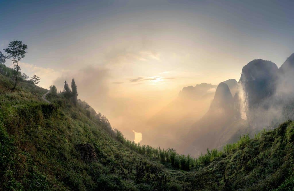
Heading about 400km southwest of Ma Pi Leng, we reach O Quy Ho Pass on National Highway 4D, which connects Lao Cai and Lai Chau provinces. This pass holds the top position in both height (around 2,000m) and length (approximately 50km), as it runs along and crosses two mountain ranges: Hoang Lien Son and Ky Quan San, home to many of the most famous and highest peaks in Vietnam. Thanks to these massive sheltering mountain ranges, the weather on the pass is unique. While the Lao Cai side may experience rain, fog, or even snow on the coldest winter days, the Lai Chau side remains sunny and warm. In summer, the hot, dry Lao winds that scorch vegetation and dry streams on the Tam Duong side in Lai Chau are blocked by the high mountains, creating a cool and refreshing climate in Sa Pa, Lao Cai. This is also one of Vietnam’s most majestic and poetic passes. From Heaven’s Gate at 1,950m, one can admire the roads that wind around the lush Tam Duong mountains, the towering peak of Mount Fansipan in the Hoang Lien Son range, and drive past Silver Waterfall, a soft ribbon of water, through the wild forest of Hoang Lien Son, to Chu Va Peak, which rises like a spear pointing straight into the sky.
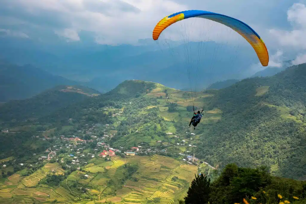
Continuing the journey on National Highway 4D and turning onto National Highway 32, which runs along the foot of the Hoang Lien Son range, we reach Than Uyen District. From here, turning right and following National Highway 279 for about 116km, we encounter Pha Din Pass. If we continue on National Highway 32, the most beautiful terraced fields in Vietnam soon come into view, on the famous Khau Pha Pass in Mu Cang Chai District in Yen Bai province. The peak of Khau Pha Pass, at 1,576m, is the widest part of the mountain’s base, offering a panoramic view of the Cao Pha Valley, its winding terraced fields surrounding the simple houses of Lim Mong and Lim Thai villages. Nestled between mountain ranges, this valley retains cold air. When the east wind blows from Nghia Lo Town, thick fog often forms in the winter. Autumn is the ideal time to conquer this pass, as the weather is dry and the natural scenery is at its most beautiful, with golden hues spreading across the valley.
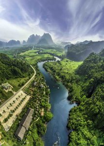
With a length of about 32km, Pha Din Pass connects the western part of Son La province with the eastern part of Dien Bien province. One side of the pass is a vertical cliff, while the other is a deep abyss, with a maximum gradient of 19% and sharp turns, making the journey both thrilling and dangerous. During the Dien Bien Phu Campaign in 1954, Pha Din Pass was a crucial route for transporting food and weapons from the rear to the front. It has become a symbol of Vietnamese people’s resilient will to overcome all hardships. Despite its treacherous nature, the scenery is poetic, with ban flowers, plum blossoms, and kapok flowers in the spring, lush greenery in the summer, and mystical fog in the winter.
The Four Great Passes of Vietnam are symbols of the wild and majestic beauty of the northern mountains and attractive destinations for explorers. For me, conquering the Four Great Passes was about more than overcoming challenging roads, providing an emotional journey, and the chance to immerse myself in the endless beauty of my homeland’s sky and earth.


