Story: Minh Yilka
Photos: Tonkin
Cua Tieu not only shapes the natural landscape of Tien Giang but also serves as a meeting point between the region’s rich natural beauty and the deep currents of national history.
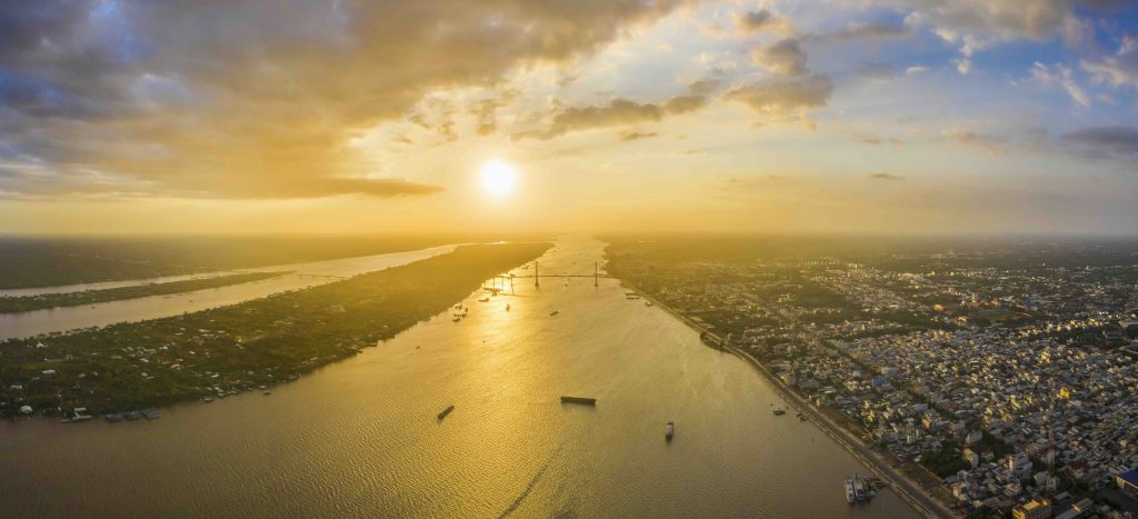
Twelfth largest in the world and seventh longest in Asia, the Mekong – also called the Cuu Long or “Nine-Dragons River” – is one of Southeast Asia’s great arteries. Rising in the mighty Himalayas, it runs more than 4,300 km, crossing a patchwork of countries and regions. From the Qinghai-Tibet Plateau, it descends through China, then winds across Myanmar, Laos, Thailand, and Cambodia before entering Vietnam, where its maze of channels finally pours into the East Sea.
In Vietnam, the river splits into two main branches: the left-bank Tien and the right-bank Hau. The Hau empties into the sea through three mouths – Dinh An, Ba Thac (now silted up), and Tran De – while the Tien fans out into six: Cua Tieu, Cua Dai, Ba Lai, Ham Luong, Co Chien, and Cung Hau. Inspired by this geography and an age-old dream of prosperity, earlier generations in the South likened the lower Mekong to nine sinuous dragons, giving rise to the name “Cuu Long Giang” – the majestic river whose nine dragon heads “spew pearls” into the sea.
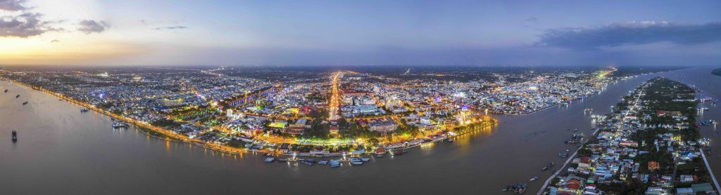
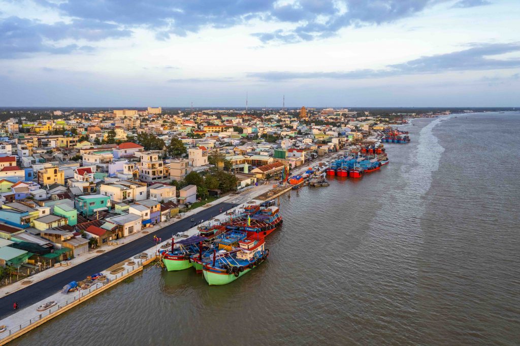
Before July 1st, 2025 (when Tien Giang Province will officially merge with Dong Thap Province), My Tho was a class I urban area of over 82,000 km2 under Tien Giang Province. Founded 340 years ago, My Tho is one of the oldest cities in the Mekong Delta, once adjoining the ancient Nguyen-era garrisons of Tran Bien, Phien Tran, and Long Ho. In Comprehensive Records about the Gia Dinh Citadel, scholar Trinh Hoai Duc wrote: “Bustling My Tho, with its tile-roofed houses and carved pillars, lofty halls and spacious pagodas, is crowded with boats from every river and sea – truly a thriving entrepôt”. Under French rule, its riverside location made My Tho a busy port where vessels from the East Sea could sail straight to the delta provinces. Thanks to this advantageous location, it became one of the first towns in the South to be planned in a Western style. Just 70 km southwest of Ho Chi Minh City, My Tho Ward remains a strategic waterborne hub, linking Vinh Long Province, Can Tho City, and other western territories.
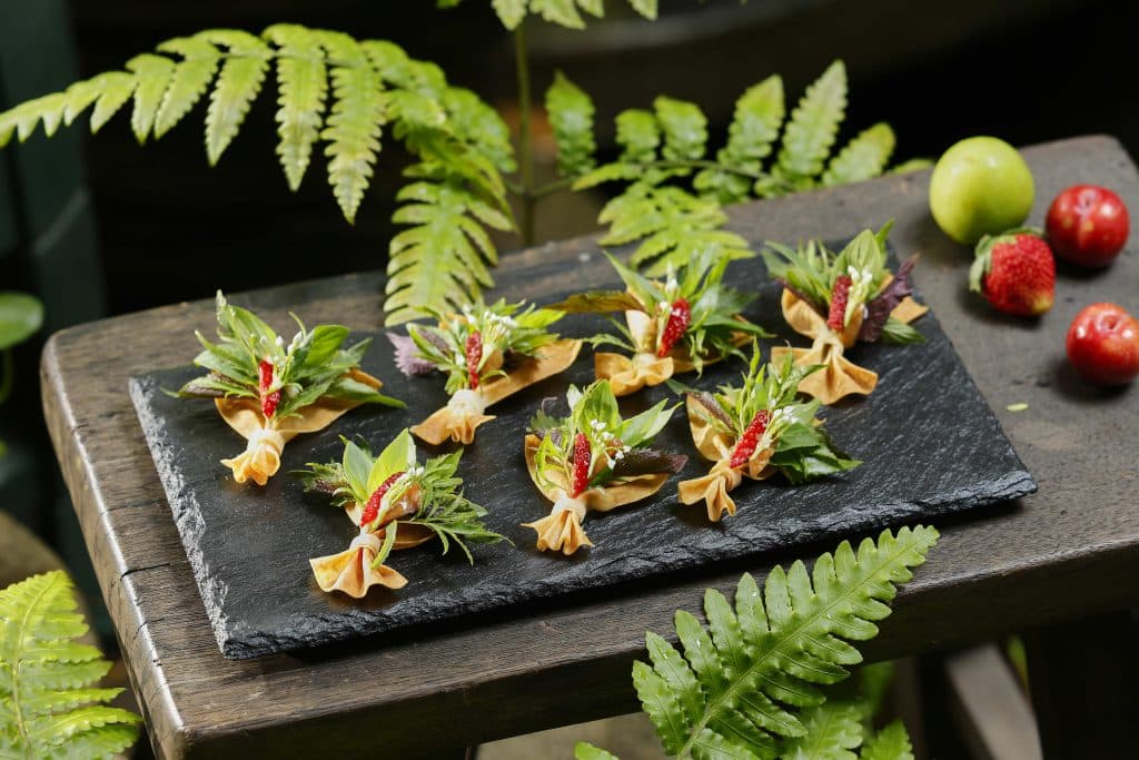
The reach of the Tien that skirts My Tho Ward is broad and placid, jade-green year-round, and vital to the region’s economy, culture, and history. Enriched by fertile silt from upstream, the land is ideal for fruit orchards, wet-rice fields, and aquaculture. Midstream islets, such as Thoi Son, located near downtown My Tho Ward, have become popular eco-tourism spots where visitors paddle sampans through narrow creeks, listen to don ca tai tu folk music, and sample freshly picked fruit.
Not far from the ward lies Cua Tieu – one of the Mekong’s nine mouths. Running roughly 45 km west to east, Cua Tieu and its twin mouth Cua Dai form the two principal outlets of the Tien. This channel regulates the river’s flow, deposits rich alluvium along the South Coast plain, and serves as a key waterway for transport, fishing, and marine commerce. The area also reverberates with history, above all the 1785 victory of Rach Gam–Xoai Mut, where Nguyen Hue shattered a 50,000-strong Siamese fleet in a dawn battle concluded within a single day – proof of Tien Giang’s strategic value. In The Veritable Records of Dai Nam, Nguyen-dynasty chroniclers later observed: “After their crushing defeat in the Year of the Dragon (1785), Siam merely boasted, yet feared the Tay Son as they would a tiger.”
The riverbanks near Cua Tieu still bear traces of the uprising led by national hero Truong Dinh. At Phao Dai Citadel, the cannons of Grand Marshal Truong Dinh once pointed seaward, first to safeguard the realm, later to defy foreign invaders. Truong Dinh Fort (also called Lu or Rach Gam Fort), built in 1861 served as the most vital base where the marshal trained insurgents and planned attacks. Strategically sited near the Rach Gam River, the fort’s earth-and-brick ramparts, bamboo palisades, shelters, and escape tunnels long slowed the French advance. Today, the Truong Dinh Uprising Sites are recognized as a National Historic Monument. Though much of the original structure succumbed to time and warfare, the restored complex stands as a symbol of patriotism and the indomitable spirit of Vietnam’s Southern people.
The Cuu Long is inseparable from the Mekong Delta, and the stretch that threads through My Tho Ward is not only scenic but steeped in culture and history. As the western gateway, this place has witnessed many turning points in the nation’s journey! From the alluvial river to Truong Dinh’s bastion, the landscape is infused with sword-bearing heroism. Time still stirs with epic verse, weaving a vivid tapestry that links past and present, keeping alive the legend of Cua Tieu at the mouth of the Nine Dragons.


