Story: Thai Nga
Photos: Minh Tu
On a satellite map, Cam Ranh Peninsula resembles a giraffe standing in the sea, its neck stretched out to graze on Cu Hin Mountain. Its body and legs lie to the south – the military zone of Cam Ranh Bay – while its head and neck lean to the north, forming a white sandy strip running from Cam Ranh Airport to the mountain’s base, situated between the East Sea and Thuy Trieu Lagoon.
As our Vietnam Airlines plane banked to begin its descent into Cam Ranh International Airport, I gazed out the window. Below, part of the giraffe-shaped peninsula reached toward Cu Hin Mountain, while Thuy Trieu Lagoon – emerald-green and shaped like a gourd, nestled in the mountain’s foothills.
Leaving the airport, we drove along a wide boulevard flanked by bright green patches scattered across the white sands of Bai Dai, in the northern end of Cam Ranh Peninsula.
A black silk ribbon through white dunes
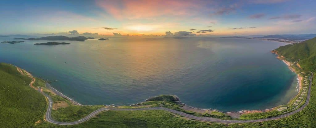
Two decades ago, Bai Dai, which stretches over 13 kilometers from Cam Ranh Airport to the base of Cu Hin Mountain, was desolate. On one side lay the empty coastline, on the other Thuy Trieu Lagoon, vividly green with mangrove forests along its shore. Between these two bodies of water, barren white dunes seemed to stretch endlessly. At that time, the only local industry was sand mining, since the white sand of Cam Ranh Peninsula is a rare and valuable mineral resource used to produce optical glass and high-grade crystal of world-famous quality.
In May 2004, Nguyen Tat Thanh Road was completed, forming a 21km-long ‘black silk ribbon’ through the white dunes and Cu Hin Pass, connecting Cam Ranh Airport and Nha Trang. The once-deserted coastline was awakened and dozens of high-end resorts and hotels were built, dotting the landscape like green gardens. Blessed with natural beauty and exceptional convenience due to its proximity to Cam Ranh International Airport, Bai Dai has quickly become a magnet for travelers from around the world.
In just the first nine months of 2024, nearly 30% of international visitors to Vietnam (approximately 3.6 million arrivals) chose Nha Trang and Bai Dai, surpassing some of the country’s most famous tourist hotspots1. The tourism boom has created jobs and significantly boosted local incomes.
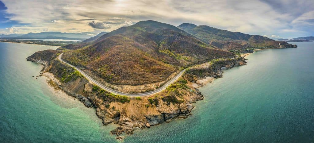
At the end of Bai Dai, the road winds along the slope of Cu Hin Mountain toward downtown Nha Trang. Caressed by the sea breeze, under brilliant golden sunshine, we walked through a colorful landscape, like an artwork created by nature. On one side lay green swathes of forest on the mountainside. On the other stretched an expanse of deep blue sea, with waves crashing in bursts of white foam against the towering cliffs below.
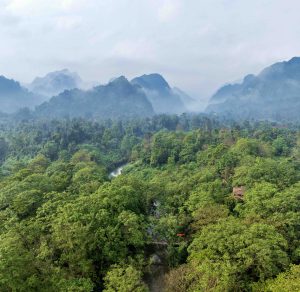
Emerald waters at the foot of Cu Hin Mountain
We continued our journey along the “black silk ribbon” of road winding through the white dunes, heading toward Thuy Trieu Lagoon. This emerald lagoon lies at the foot of Cu Hin Mountain, on the western side of Cam Ranh Peninsula.
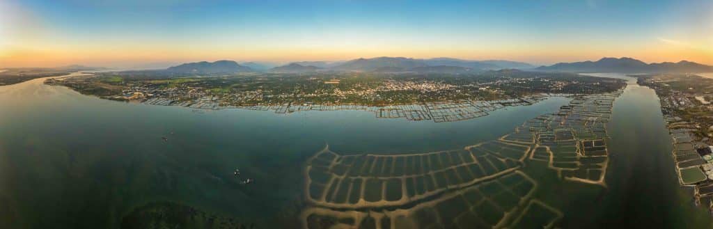
The lagoon is shaped like an inverted gourd, its base resting against the mountainside and its mouth gently opening into Cam Ranh Bay. It was formed when tidal flows from the bay crept inland to the base of the mountains, gradually giving rise to a marshy ecosystem rich with mangroves. The lagoon takes its name from the ancient village of Thuy Trieu (now part of Cam Hai Dong Commune), located on its eastern bank.
The golden sunrise lit up the mountainside. Early rays of light swept across the white dunes and cast a warm glow on the lagoon’s clear blue water. The surface reflected the shadows of drifting clouds and towering mountains. Shrimp ponds, laid out like checkered squares, clustered close together, leaving a wide channel of water at the narrowest point where Moi Bridge crosses Dinh Tien Hoang Road.
Having significantly declined in area over the past 20 years, the mangrove ecosystem lining the lagoon is gradually being restored. Along the swamp’s edges, the intricate root systems of clumps of mangrove trees provide an ideal nursery for young marine species like fish, shrimp, blood cockles, etc. Blood cockles are the most renowned specialty of Thuy Trieu Lagoon, widely regarded as among the finest in the country.
We wandered along Thuy Trieu Road on the east bank, visiting sites built by long-ago migrants who settled near the lagoon: Thanh Son Pagoda, Thanh Trieu Pagoda, and Thuy Trieu Communal House, still standing quietly by the water’s edge, their timeless presence creating a contemplative mood. In the early evening, sunset cast a pale violet hue over the lagoon as locals waded through the mud to harvest blood cockles. These shellfish lie just beneath a thin layer of mud, making them easy to catch by hand. Laughter and cheerful voices echoed in the breeze, drifting gently across the water’s surface. Stopping at a small roadside eatery near Moi Bridge, we enjoyed a feast of grilled blood cockles, their rich, buttery flavor paired perfectly with lime-pepper salt and fresh Vietnamese coriander, finished off with a steaming bowl of cockle porridge, its peppery warmth balanced by the natural sweetness of the shellfish.
Leaving Cam Ranh Peninsula, memories of the green lagoon shimmering under the sun at the base of Cu Hin Mountain and the soft black ribbon of road unfurling across endless white dunes remained vivid in my mind.


